Keeping Dutch feet dry is mainly done by placing piles of sand along the coast as “nourishments”. These nourishments build out the beaches and dunes to act as a protective buffer against storms. However, as was recently pointed out by an official at Rijkswaterstaat, the Dutch water ministry, the Hamvraag or “bacon question” is still “where the heck does all that sand actually go?”
Knowing where nourished sand goes is important for understanding the ecological impact of nourishments, as well as their effectiveness. If you want your sand to reach a certain destination, how much of it actually gets there and how quickly?
Today’s sand sample is from Clatsop Beach, Oregon, on the Pacific Northwest coast of the US. Last summer I spent several months modelling sediment transport at the mouth of the Columbia River with the US Geological survey, and had the great privilege of making a site visit at the end of my stay.
Working in partnership with Oregon State University and the Washington State Department of Ecology, I assisted with a topographic survey of the beaches surrounding the Columbia. Half the team surveyed the submerged parts of the beaches via jetski, and my group walked transects across the beach and up the dunes using backpack-mounted GPS units.
Starting at far-too-early-in-the-morning, our team split off individually, and I had an entire kilometers-long stretch of the beach to myself until almost lunch time, when we reconvened. I love long walks on the beach and take great pleasure in that sort of solitude in nature, and it was even cooler to do that while collecting data that could help the project I was working on. The digital computer model I had worked on all summer was now suddenly a real place where I could feel the sand between my toes.
Gold in Them Hills
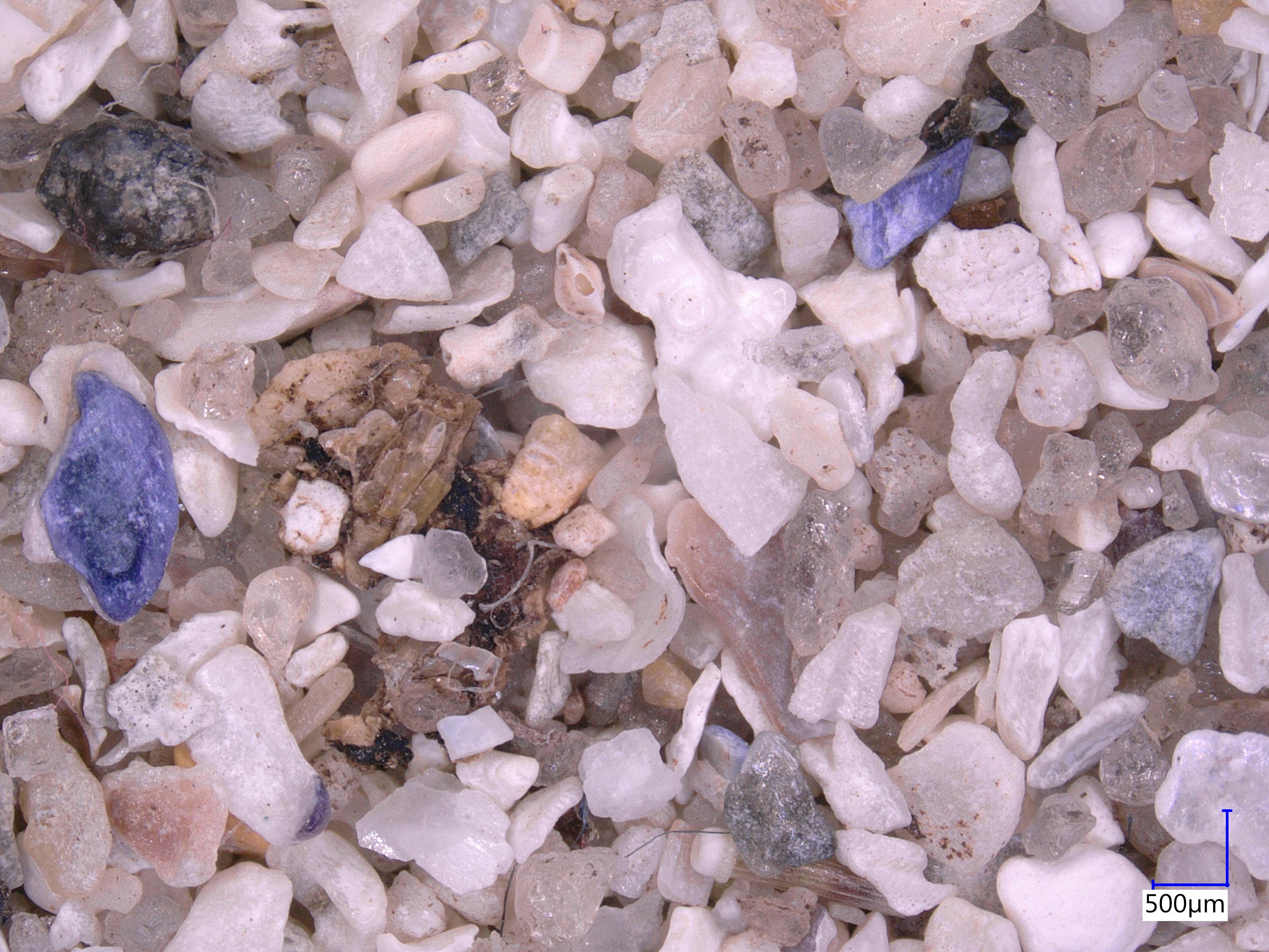
The sand at this beach is interesting because of the black grains we see scattered throughout. This sediment is made of minerals like chromite, magnetite, and garnet, which are heavier than the whitish quartz grains we see around them. These deposits, known as “placers”, were transported to the sea from the mountains inland by the Columbia River. They form on the beach because lighter minerals like quartz are preferentially sifted out by waves and currents, leaving more of the dense particles behind. This even includes trace amounts of gold! Can you see any in the photograph below?
Sediment sample from Clatsop Beach, OR. Note the black “placer” deposits of heavy minerals. Can you see any flecks of gold?
At the end of our survey, I walked along the beach to check out a surprising object emerging from the sand: the wreck of the Peter Iredale, a sailing ship that ran aground there in 1906:
The Wreck of the Peter Iredale on Clatsop Beach.
Known as the “Graveyard of the Pacific“, the mouth of the Columbia is truly a “killer ebb-tidal delta”: huge waves and powerful currents meet violently, and have caused dozens of shipwrecks over the past few centuries. This makes effective management of the sediment there crucial for safe navigation, keeping the shipping channel dredged clear and disposing of the sediment in environmentally-friendly, cost-effective, and useful ways.
Historical shipwrecks at the Mouth of the Columbia River, seen in the Columbia River Maritime Museum.
Strategic placement of this dredged sediment was the focus of my time at USGS last summer, but I will delve into that more in a future post!
Vancouver holds a special place in my heart. I was born out there, and even though we moved away when I was very young, it has continued to re-emerge in my life. In 2011, I moved out there after a difficult breakup and the city breathed new life back into me. While there, I discovered a new vocation in hydraulic modelling for predicting floods, something that I am still doing to this day. I have returned to Vancouver a number of times since then, since my brother and a surprising number of my closest friends have ended up out there. I hope to return this September for a wedding!
Coal Harbour, Vancouver.
One of my favourite parts of Vancouver is walking its coastline. The city was built on the edge of a large fjord, but has a variety of coastal landscapes, from towering cliffs to sandy beaches, mud flats to salt marshes, and of course a number of urbanized shorelines.
Even though I am in the Netherlands now, I am trying to keep my Vancouver connection alive through my work. Last year, I co-supervised a fantastic group of TU Delft students who worked with Kerr Wood Leidal and the University of British Columbia (UBC) to investigate the erosion of the Point Grey cliffs, on which UBC is situated.
Eroding cliffs of Point Grey. The University of British Columbia is at the top of the cliff, so naturally they are concerned with understanding the rate of erosion and means of slowing it.
The project was an interesting one, as the students (representing three different countries) tried to bring their lessons learned about Dutch coastal engineering to Canada. Canadian coastal zone management is much more fragmented than in the Netherlands, where everything is more or less centrally controlled by the federal government. The entire Dutch coastline is also incredibly well-monitored, with high resolution bathymetry taken every few years, and with countless other measurements available. Acquiring the data necessary to perform a coastal engineering study in Vancouver required contacting dozens of different sources and dealing with numerous agencies at multiple levels of government.
Sand from Wreck Beach. It is quite coarse and angular in shape, and the green and red tints are quite nice. Being glacial in origin, these sand grains have likely been bulldozed by ice or carried by meltwater from far and wide. This accounts for the variety of particles we see.
In the end, the students looked at a number of possible solutions for slowing the coastal retreat, including sand nourishments and revetments. One of the most intriguing concepts that they explored was the idea of a clam garden, a traditional approach from the First Nations people living on the BC coastline. Originally intended for aquaculture, clam gardens are usually small rock walls placed along gravel beaches, behind which where clam-friendly sand or mud can accumulate. However, this approach could have added benefits for coastal protection by attenuating waves and encouraging the deposition of sediment. In many ways, it is not that different from the Dutch using brushwood dams to reclaim land in the Netherlands or my colleagues using similar structures to rebuild mangrove habitats.
In Canada, the involvement of First Nations in coastal planning is becoming increasingly important (as I think it should be!), and there is a lot that science and engineering can benefit from their traditional forms of knowledge and experience. Building with nature instead of fighting against it has recently become a popular design philosophy in coastal engineering, and who better to have as allies in that task than the people who have been living with and building with nature already for centuries?
World War II-era bunker on Wreck Beach overlooking the Georgia Strait, with North Vancouver in the background.
The Delft-Vancouver connection continues: right now we have a group of five students investigating coastal protection solutions with Kerr Wood Leidal and the Tsleil-Waututh Nation. They have already been out there for a month, and I am excited to see what they come up with!
Sunset over the Spanish Banks, just around the corner from UBC.
It’s February, which means it’s Coastal Dynamics season again! 5 years ago (time flies!), I first arrived in the Netherlands as part of my master’s program. I walked into the classroom for Judith Bosboom’s Coastal Dynamics 1 course, and it really changed everything for me. CD1 felt like the course I had been waiting for all my life, combining geology, geography, physics, and practical engineering all in one package. The course was also so well-taught and structured that it seemed like an IV drip of knowledge, pulsing straight to your brain. I felt like I was truly in the right place and coastal engineering was the field for me. It cranked my enthusiasm for all things coastal to 11.
After I became a PhD student, I began TAing the course and learned what it was like on the other side of the classroom. This revealed a hitherto unsuspected enthusiasm for teaching (although perhaps it shouldn’t have been a big surprise, given that I come from a large family of teachers), and has been a big factor in my interest to stay in academia.
Every year, we start the course by showing students the video “River of Sand”, which explains coastal sediment transport in an easily understandable way. This video is 55 years old now, but it still does a better job of explaining how beaches work than almost anything else I’ve seen. I hope you enjoy it as much as we do!
A few weeks ago, I shared some sand that my dad brought back from the Butt of Lewis. On that same trip, he and my mom went to visit the island of Barra, where her family originated from before emigrating to eastern Canada in the 1770s.
Halfway through their holiday, I received an excited text message from my dad: “Tell me – the whole island seems like grey granite, so where does the white sand come from? (In fact all the west side beaches are white sand.) Is it coral?”
Eager for a distraction from my work, I did a quick lit review. The consensus seems that indeed, the white sand on the beaches has almost nothing to do with the gneiss found on the rest of the island. In essence, it seems as though most of the original sand was bulldozed there by glaciers during the last ice age or brought there by meltwater as they retreated. Then over the course of the past few thousand years, shell fragments have accumulated and overwhelmed the native glacial sand, making up 7.5% to 82.9% of the total sand. This results in the beautiful white beaches that you see today (Jehu & Craig, 1924; Goodenough & Merritt, 2007).
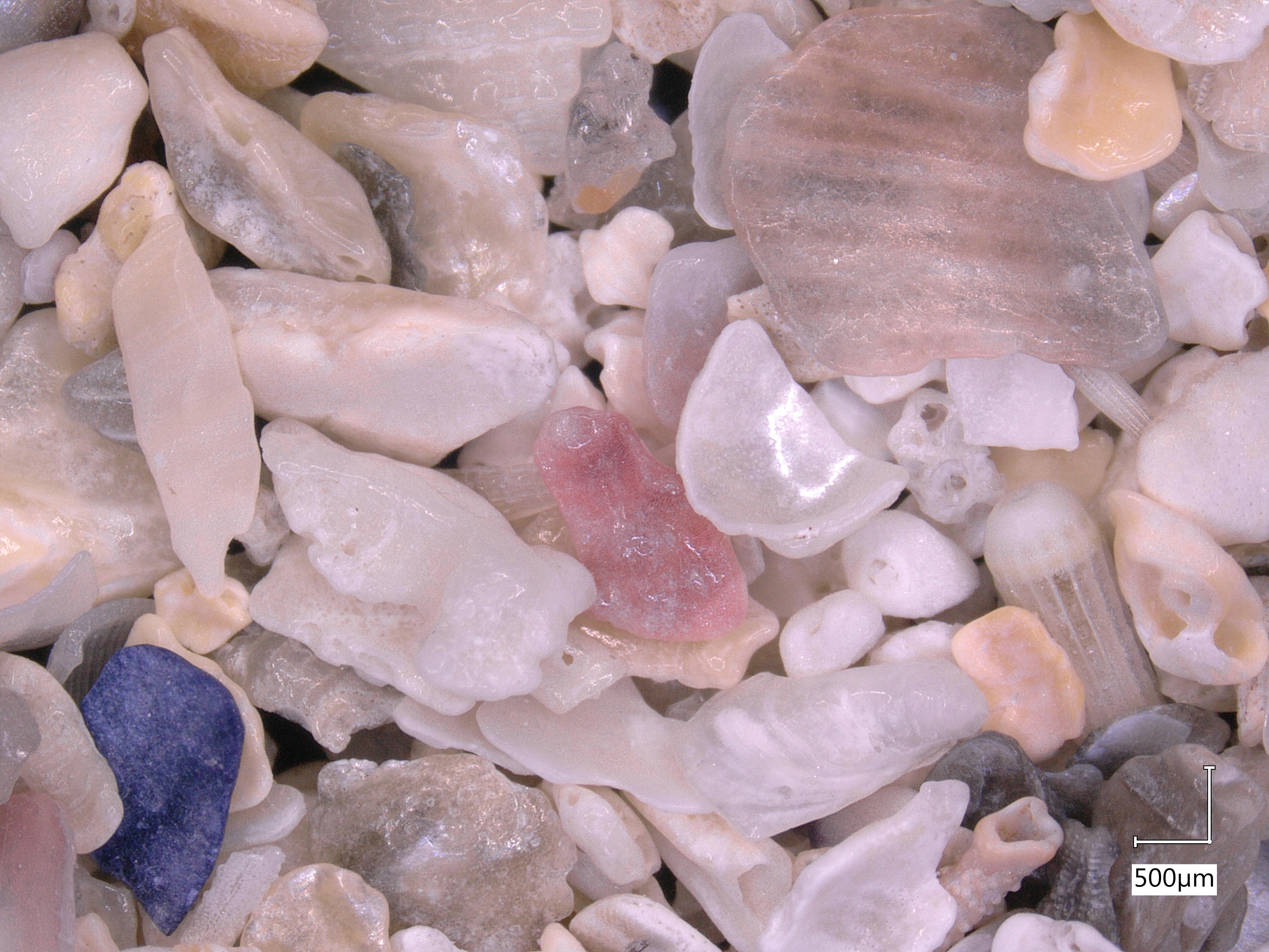
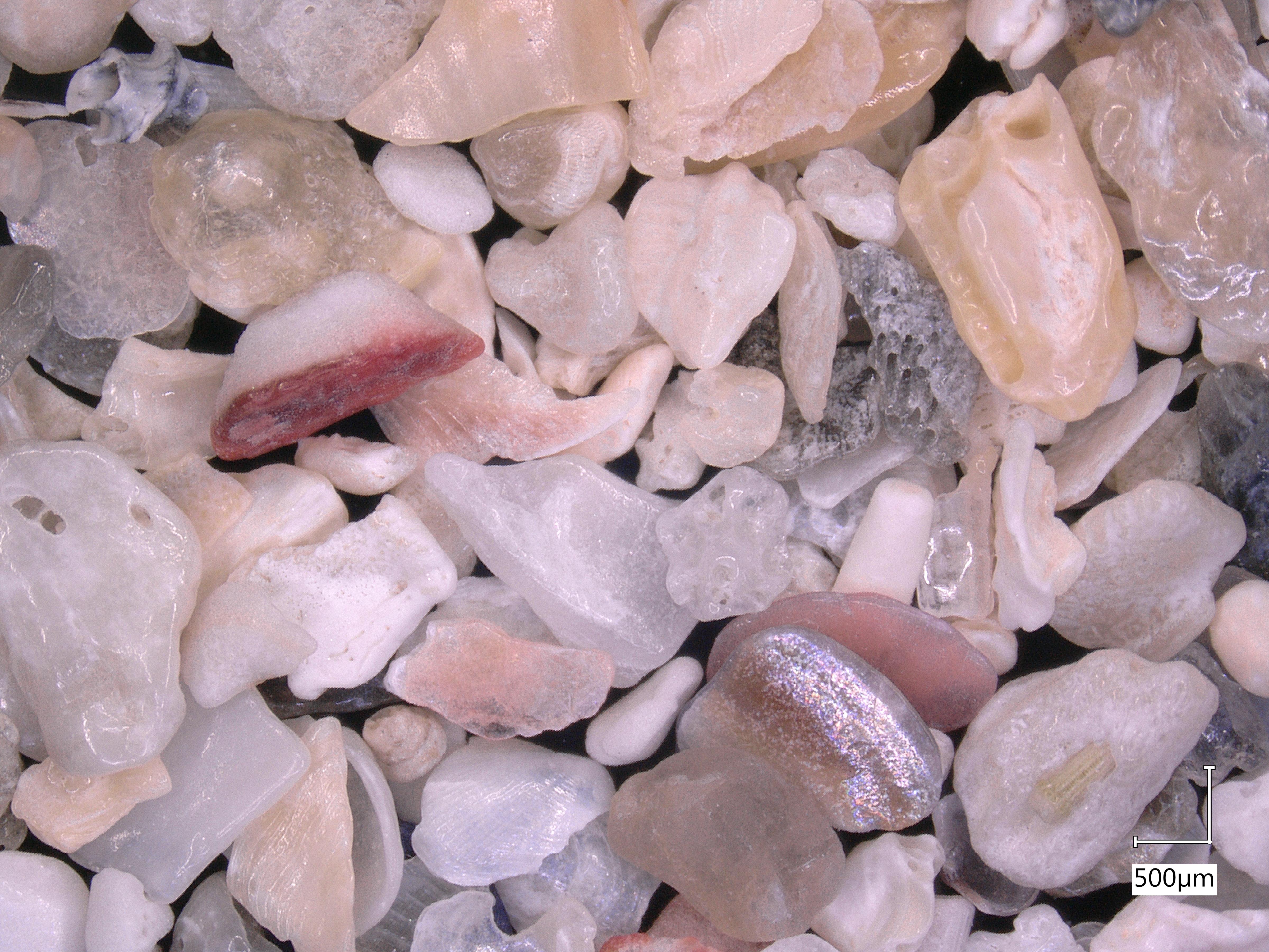
This might be my favourite sample of sand that I have analyzed yet- it is incredibly shelly, and every photo reveals beautiful new shapes and patterns. I think I will just let the sand speak for itself:
When you zoom out, it doesn’t look like much…
…but zooming in reveals all sorts of interesting shell fragments with different structures and colours.
I particularly love the piece in the middle of this photo: it almost looks like a piece of glazed pottery.
I’m really quite curious as to what the red and white fragment in the upper left quadrant is. It looks like a piece of octopus tentacle, although I know it can’t be!
Purple is my favourite colour, so I love the shade of the fragment in the lower left corner. It actually looks a lot like the coralline algae we saw in my photographs of sand from Archipel Glenans. I wonder if something similar is present offshore of Barra… The cylindrical fragment on the right side makes me think of a Roman column.
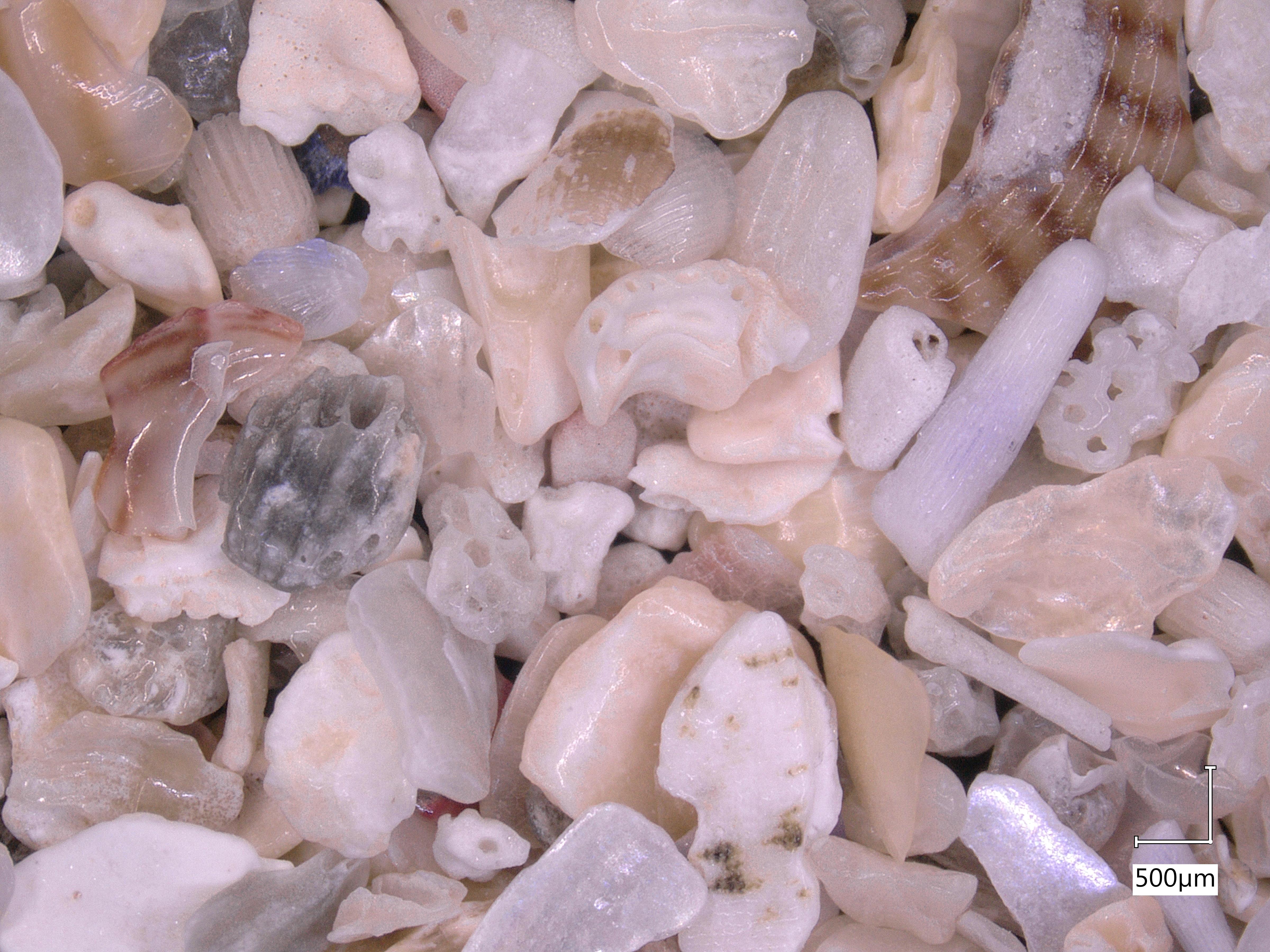
This one might be favourite- I zoomed in to 40x magnification to take a closer look. The patterns of the white bubbles are beautiful- I am very curious whether that is a shell fragment or actually some sort of igneous rock left over from Scotland’s volcanic days…
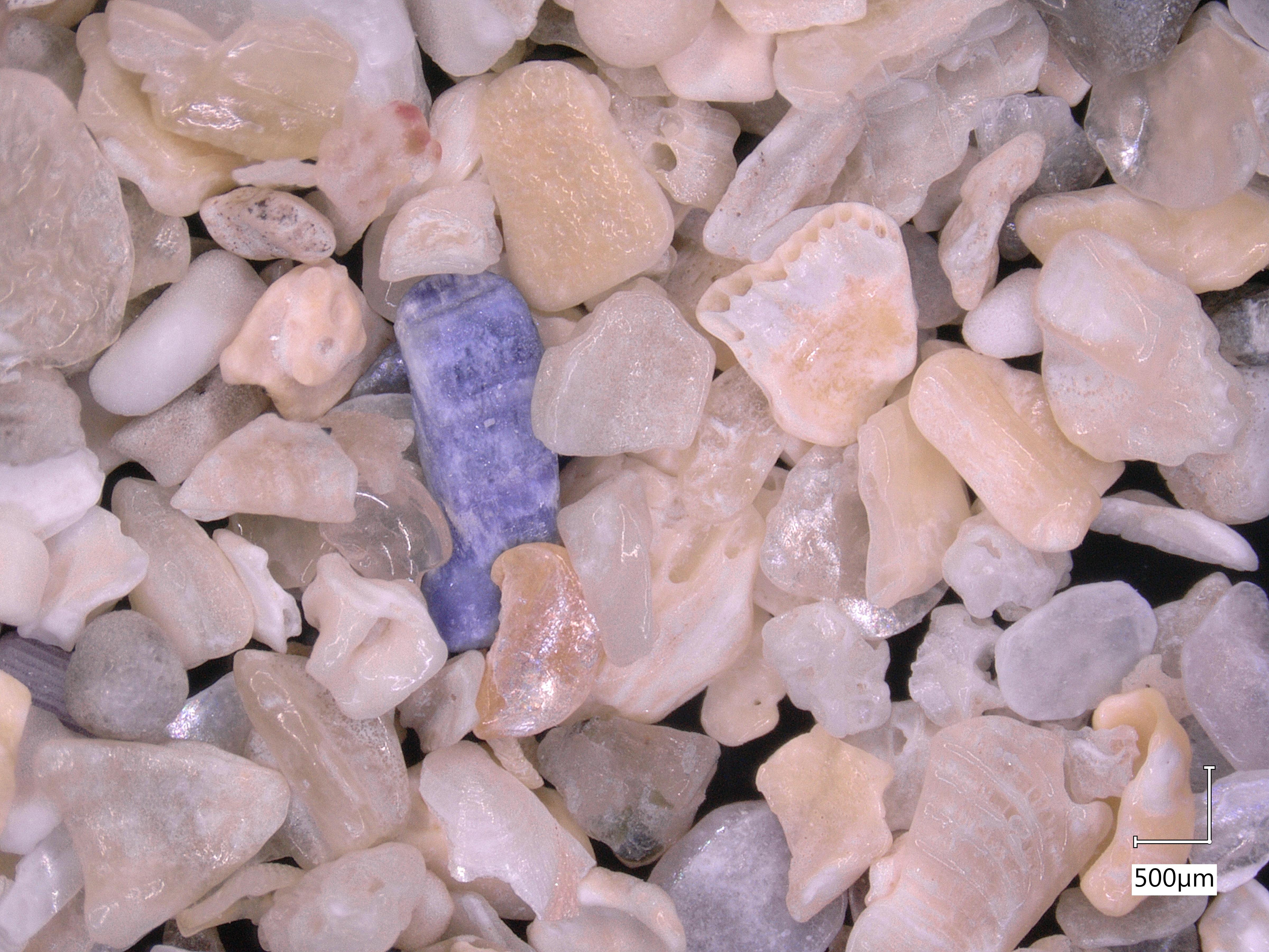
I love the iridescence of the shell at mid-right, and the vivid pink streak in the top left quadrant. So many cool shapes and colours!
I hope you enjoyed those as much as I did. I just wish I knew more about ecology so that I had a better idea of what we were actually seeing here!
I recently paid a visit to my grandmother in Glasgow, Scotland. She is 94 1/2 years old and is still a delight to be with. Since she is living in a retirement home now and doesn’t get out much these days, I rented a car and we went for a drive together down the coast to Troon:
On our way back to Glasgow I pulled over the car in Ardrossan and grabbed a handful of sand from the beach there:
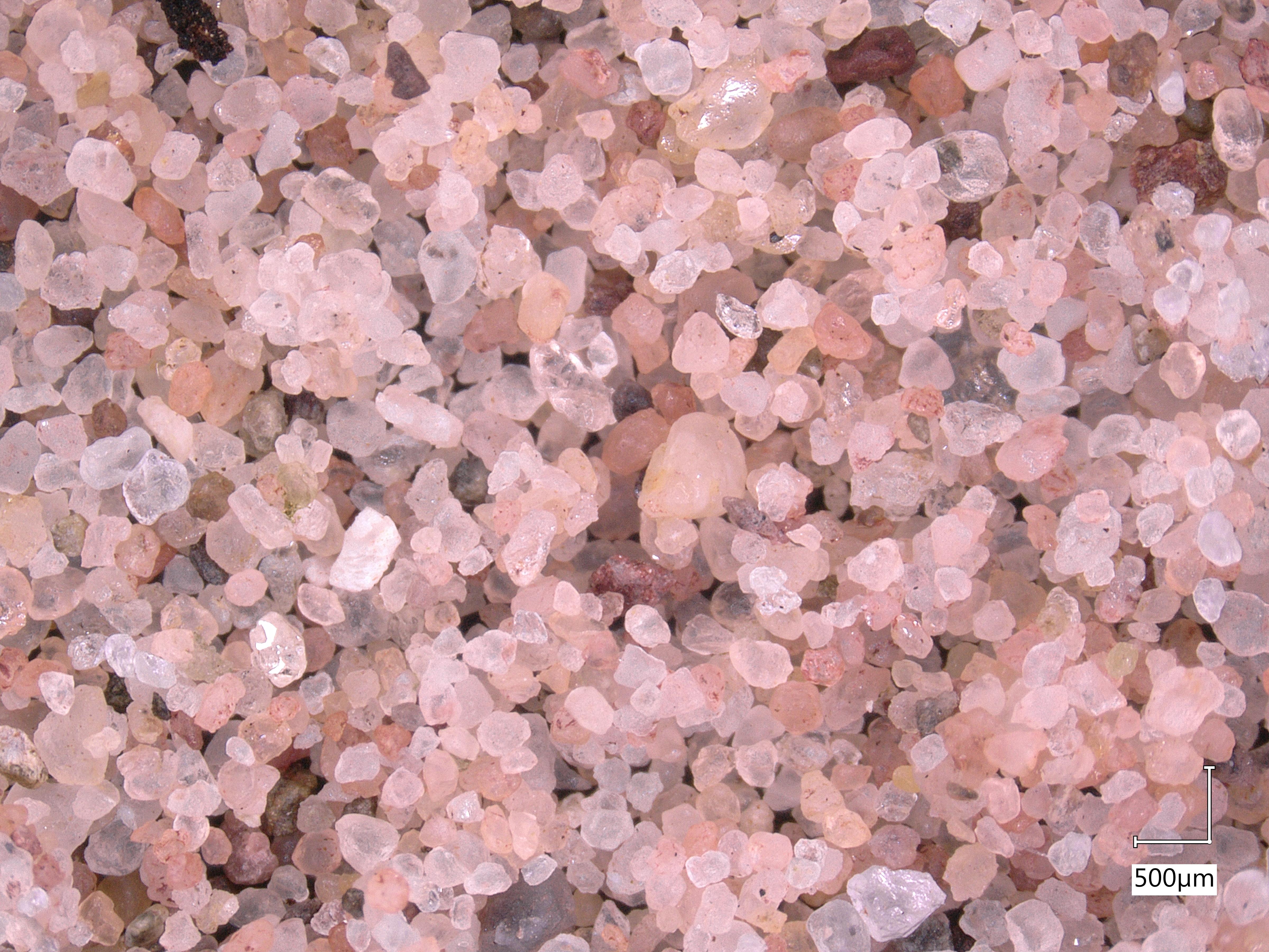
Sand from the beach at Ardrossan, Scotland. It appears to be fine, well-rounded quartz sand. Note the beautiful red tint of the grains.
When I showed my dad this photo, he pointed out that the pink sand grains resembled the red sandstones found in houses and buildings all across Glasgow, the city where he grew up. When I looked into it further, it seems that many of the sandstone bricks used in facades across the city indeed came from Ayrshire, where this beach was located. This is backed up by a geological map of the Firth of Clyde, which shows our little beach comfortably inside the red sandstone zone. A delightful convergence of sediment and architecture!
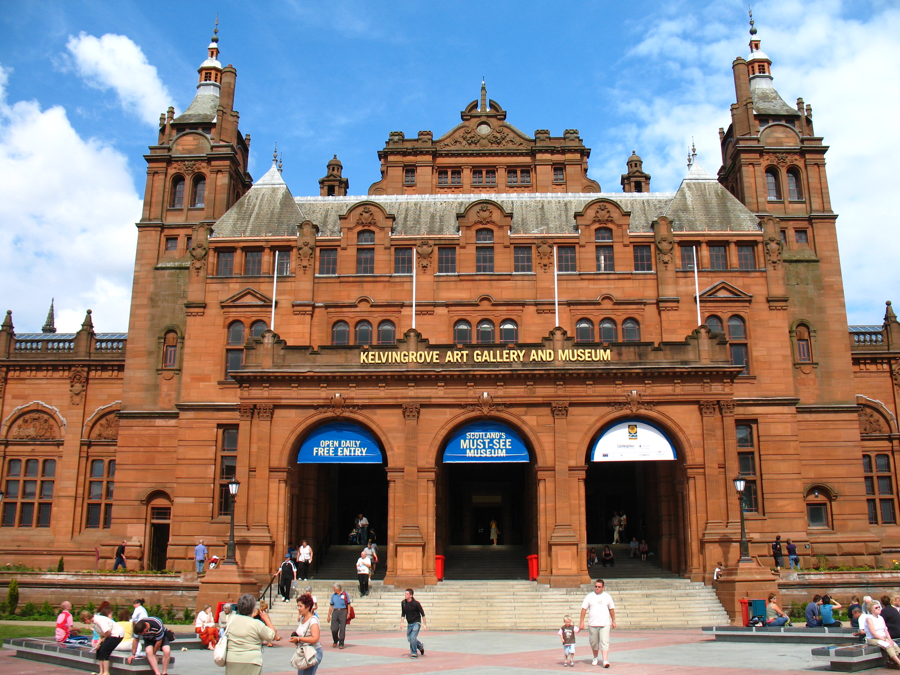
The Kelvingrove Gallery, one of my favourite places in Glasgow. If you ever find yourself in Glasgow I highly recommend it- it’s free! Note the beautiful red sandstone facade.
That’s one of my favourite things about this field- there always seems to be new and interesting connections back to other things that I love!
Majestic highland cows in Pollock County Park, Glasgow. Note their beautiful red sandstone facades.
This week our sand comes from the delightfully-named Butt of Lewis, the northernmost point of the Isle of Lewis. Lewis is part of the Outer Hebrides, an archipelago off the west coast of Scotland. My parents visited there this summer as part of a trip to Barra, a neighbouring island and the ancestral home of my mom’s family. My dad brought back a little bag of sand from the beach at Ness:
The most important question here is obviously not about the sand though, but rather, why they called this place the “Butt of Lewis”. After half an hour of creative and persistent googling, I couldn’t find anything, though. My guess is just that it’s because it’s at the very back end of the island. But also quite windy?
Live, from the windy Butt of Lewis… [Source: BBC Weather]
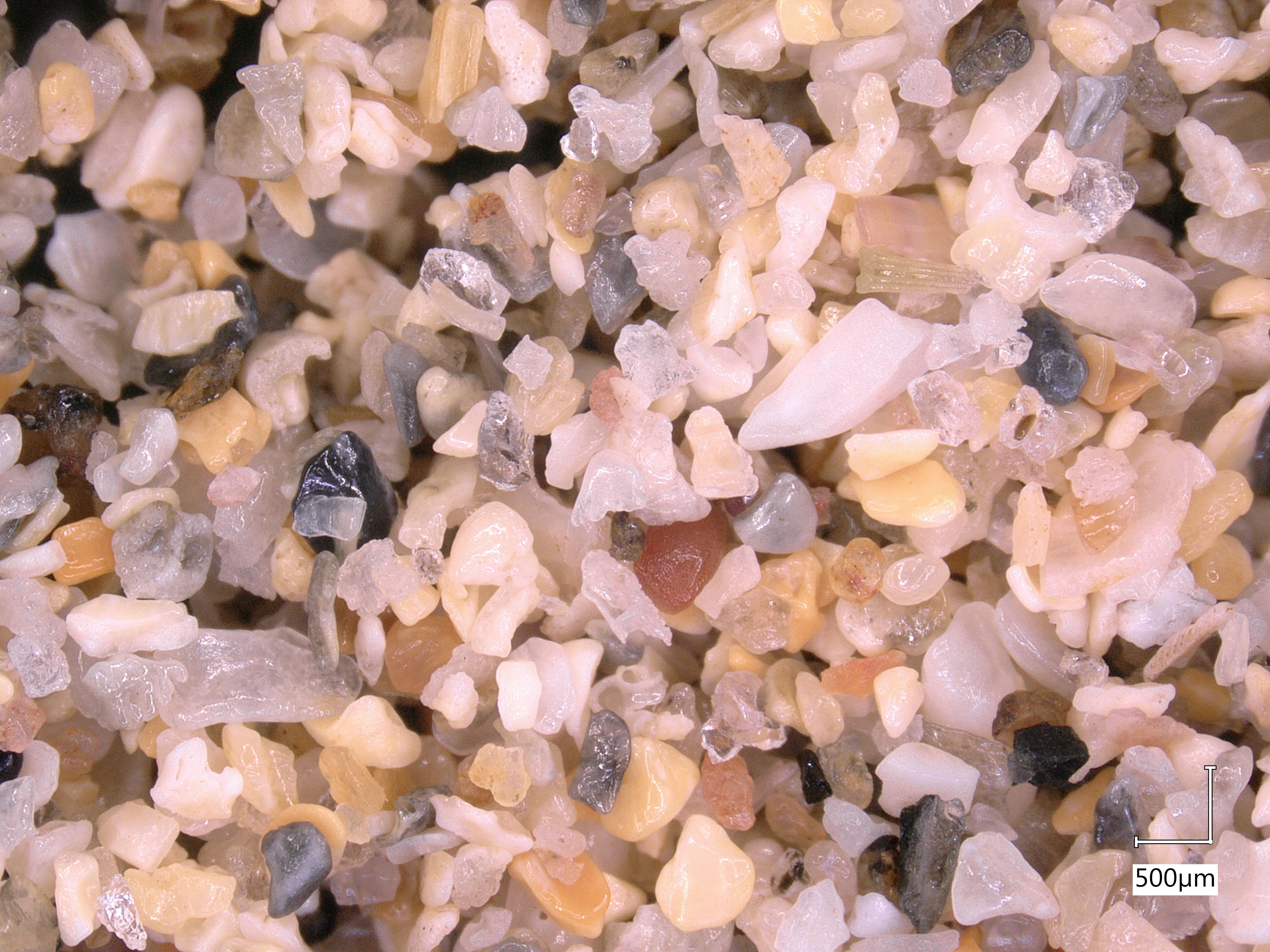
This week, we have sand from the beach at Le Vourc’h near Porspoder in Brittany, France. I just returned from a two-month research visit to IFREMER in Brest, and while I was out there I was fortunate enough to rent a car and tour the countryside.
The beach appears to be mostly white quartz sand, but this sample had a single mysterious black grain, sticking out of the picture like the monolith in 2001: A Space Odyssey.
Sand from Porspoder Beach in Brittany, France
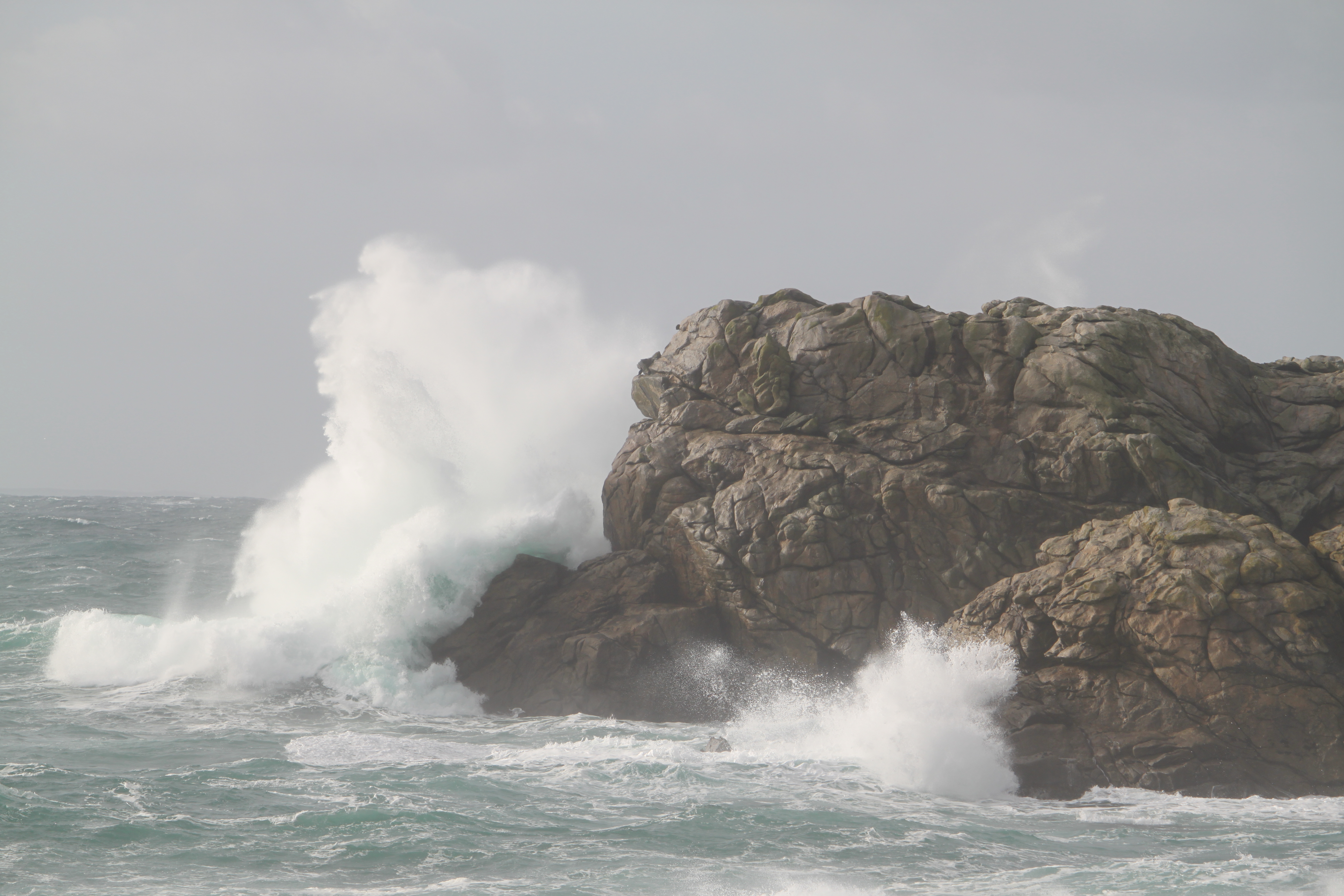
When I visited in November, the rocks surrounding this beach were being absolutely pulverized by massive waves, and this was only during a “minor” storm.
Nothing like watching >4 m waves smash against rocks for half an hour to remind yourself that you are a puny human who is lucky to be alive in the face of natural forces that care not one iota about our well being.
My friend Claudia responded with great zeal to my call for sand from different beaches around the world. In addition to her samples from Sword Beach and Dunkirk, she also brought back sand from her holiday to the Greek island of Crete. The sand from Xerokambos Beach is interesting compared to those two French beaches, since it is much more diverse- there are many different colours and likely different mineral origins for the sand grains that we see there.
That being said, when I see pictures of how lovely Crete looks, I have the feeling that I would not be too focused on the finer details of local sand composition if I went on holiday there!
Ga je naar het strand? Mag ik
als je terug komt het zand
uit je schoenen voor
de bodem van mijn aquarium?
—
Are you going to the beach?
when you come back, may I have the sand
from your shoes for
the bottom of my aquarium?
– K. Schippers
I have had that Dutch poem on a postcard on my bedroom wall for a few years now, but it unexpectedly came to life a few weeks ago. I mentioned to some friends that I was taking pictures of sand from different beaches with a microscope and wanted to expand my collection. My colleague Silke enthusiastically responded- she had just returned from a holiday in France and still had sand in her shoes! “Should I bring it to the office tomorrow?” she asked. How could I say no?
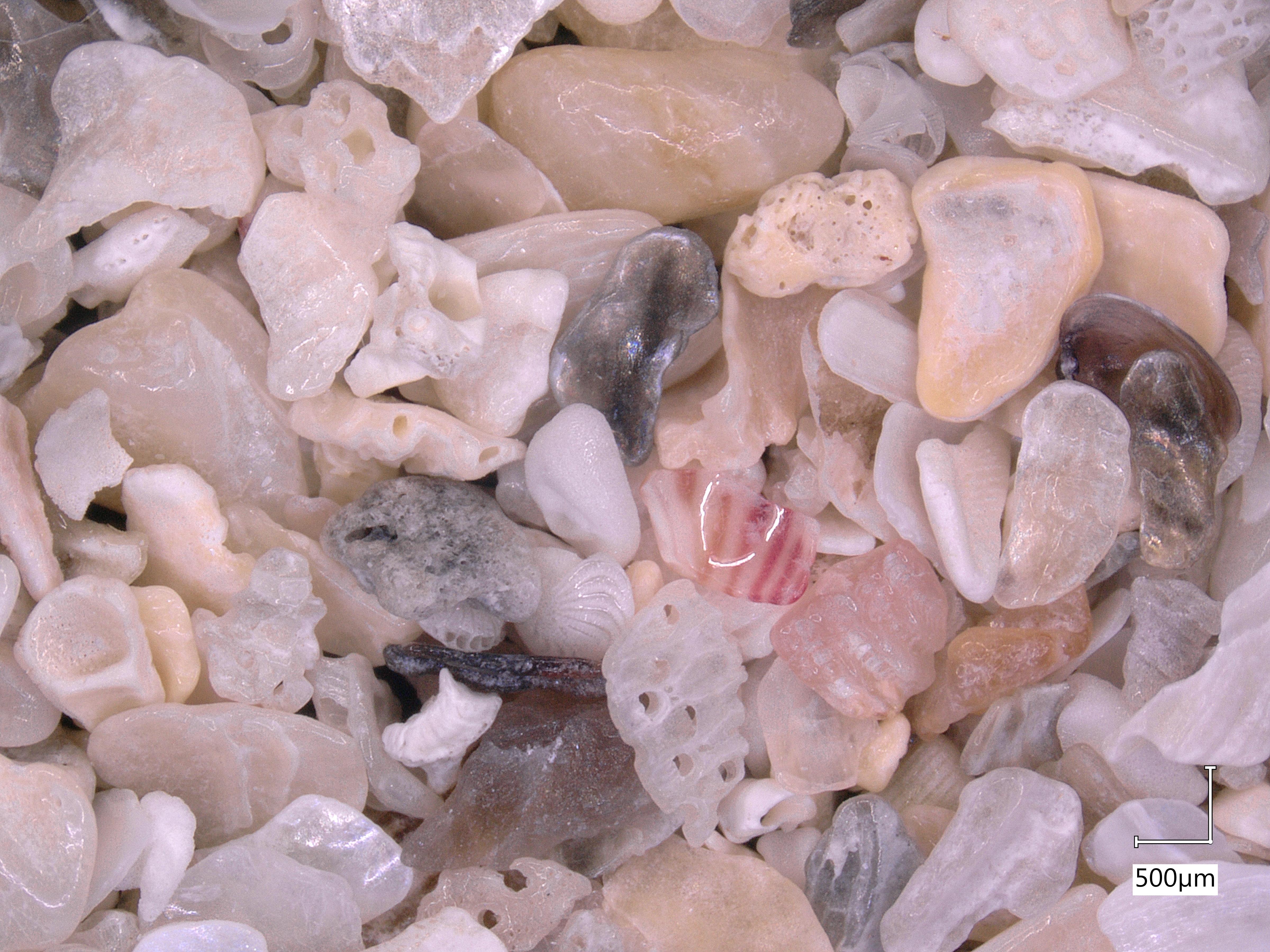
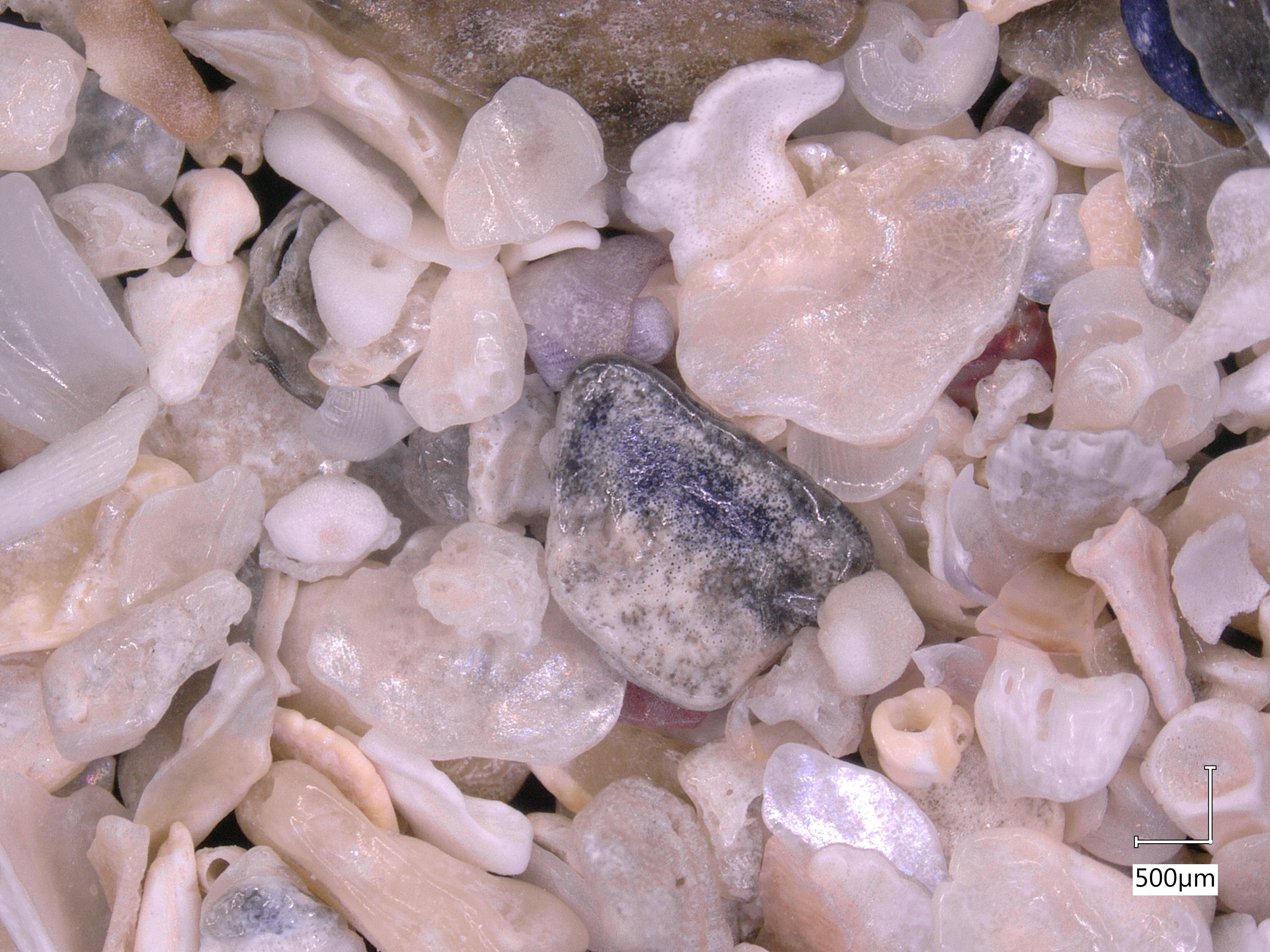
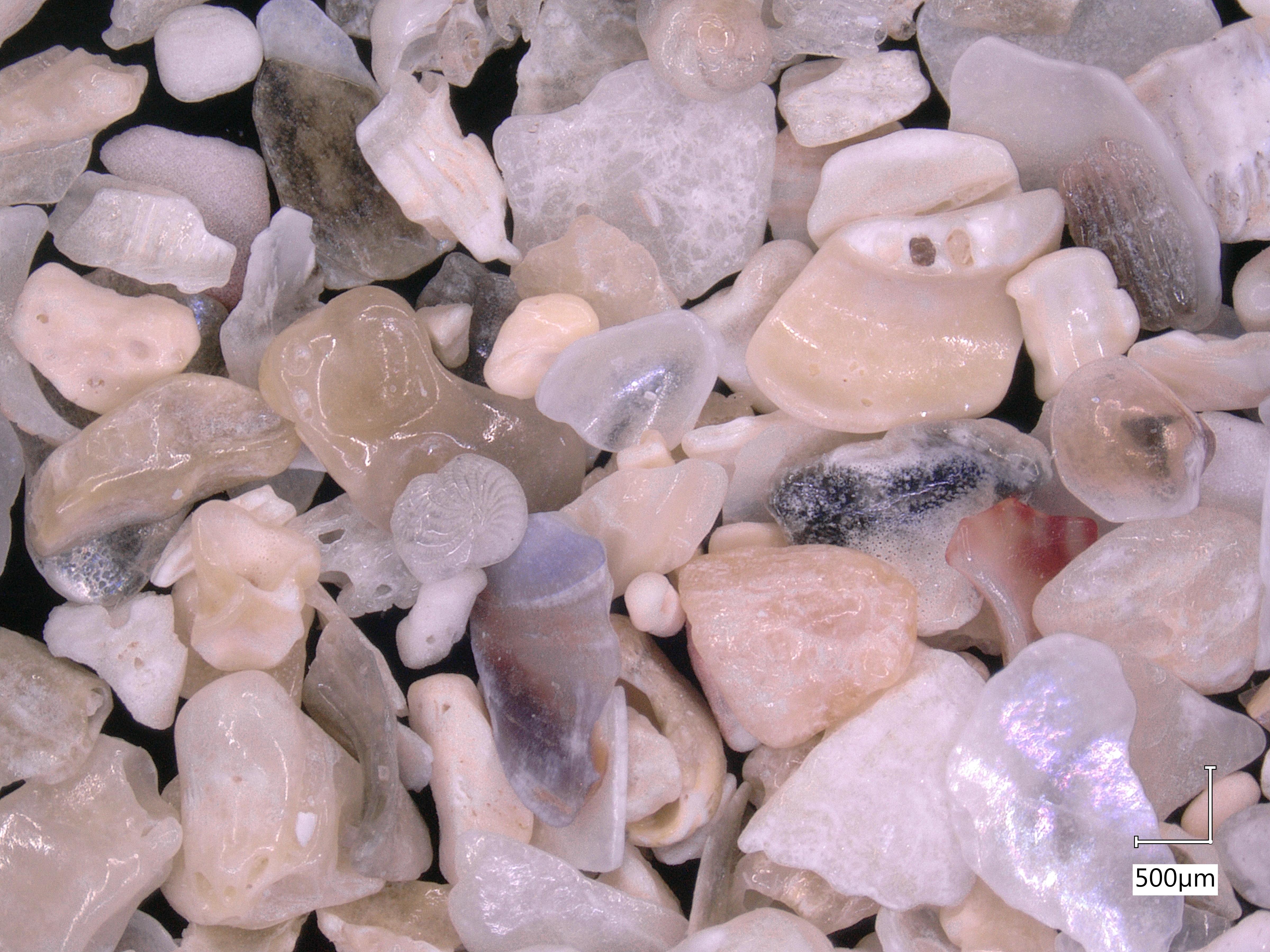
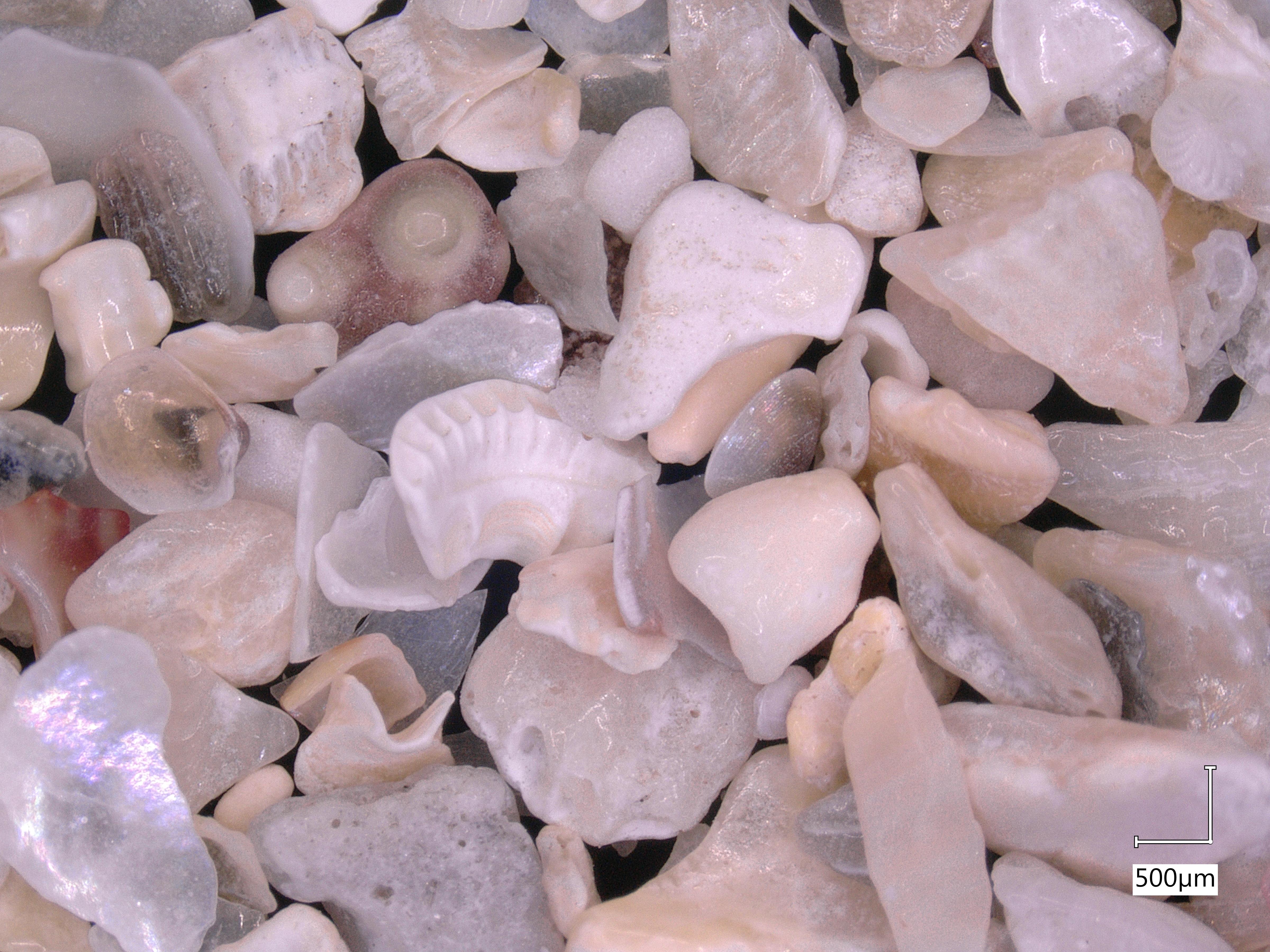
Her holidays had taken her to the beautiful Glenans Archipelago off the coast of Brittany, not too far from where I am living right now in Brest. Unlike a lot of the sand I have looked at so far (which was mainly quartz), this beach appears to be quite shelly. The islands are famous for their maerl beds, a sort of coral algae rich in limestone. That may account for some of the interesting shapes and colours we see, but if you look closely, it seems there are also some threads and bits of lint from Silke’s socks! It might not be a scientifically valid sample, but I’ll take it!